Updated UH Mānoa map highlights campus features
The map helps users locate amenities and points of interest as well as the many features of the campus.


The map helps users locate amenities and points of interest as well as the many features of the campus.

Kaylyn Ells-Hoʻokano and Drew Kapp created a map showing details of the traditional land divisions in Puna that also honors their original names.

A new online map provides users with many choices to find what services they are looking for on the UH Mānoa campus.
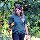
Users can filter by plant family or other traits and view the location and information for 1,054 arboretum accessions currently on the map.

Seven stunning examples of raised relief maps are tucked away in the lobby of St. John Plant Science Lab on the UH Mānoa campus.

SOEST researchers discover nearly 125 mile-wide “lobes” of uplift and subsidence straddling the fault system.
The UH Hilo Spatial Data Analysis and Visualization Lab released a study on agricultural land use which provides information on the location of commercial agriculture activities statewide.
