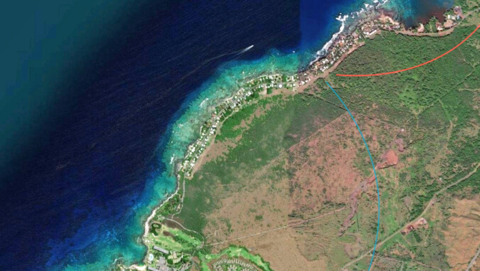
A University of Hawaiʻi at Hilo alumna is shedding light on the critical decline of reef and water quality on the Kohala coast with an innovative interactive “story map.” Katie Gaut, who founded Blue Water GIS, a geographic information system firm, inputted data collected by UH Hilo marine scientists to create the Puakō Reef StoryMap, Wahi Pana which documents alarming sewage pollution issues impacting one of Hawaiʻi’s most important coral reefs.

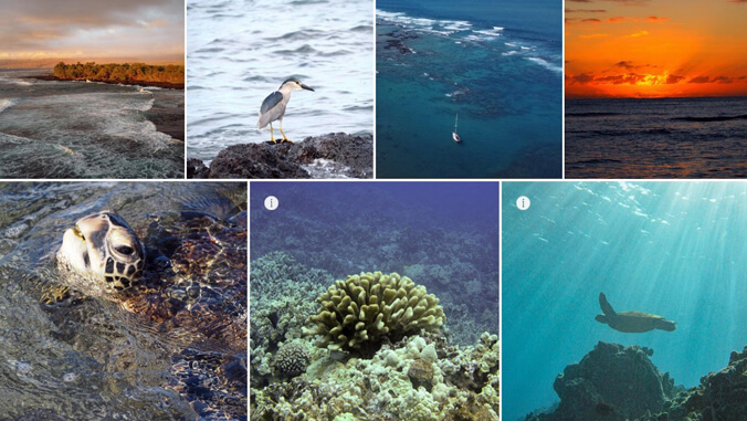
Once boasting 53% coral cover, Puakō’s reef has plummeted to less than 5% and according to experts is on the verge of collapse. The story map documents sewage pollution issues at Puakō, backed by scientific research conducted through the years by UH Hilo marine science faculty and students. Lead researchers on the Puakō project are marine science professors Tracy Wiegner, Steve Colbert and Jim Beets, an emeritus professor who mentored Gaut during her graduate studies.
- Related UH News story: Puakō sewage runoff leads to wastewater treatment plant recommendation, December 13, 2021
“It’s not the kind of water that I would want to be swimming in, and it also has implications for our coral reef health,” said Colbert.
Hope for restoration

Despite the grim data, the story map offers hope, highlighting efforts by local residents and scientists to restore the reef.
“This is about more than just the reef, it’s about respect for land and culture,” said Kawehi Apo, a Puakō descendant and cultural practitioner.
Since 2014, UH Hilo researchers have been studying the Puakō reef, uncovering the damaging effects of sewage on coastal waters. Their data reveals elevated levels of harmful bacteria, pathogens, and nutrients that exceed health department standards. Excess nutrients like nitrogen and phosphorus fuel the growth of marine algae, which suffocates the coral. The area has also experienced coral die-offs and bleaching events, worsened by pollution.
UH Hilo based research reveals that wastewater from homes in the area enters the ocean within hours, contributing to the reef’s rapid decline.
- Related UH News story: UH Hilo researchers track sewage leakage rate into Kahaluʻu Bay, August 19, 2024
The story map shows that solutions are possible and features photos and visuals expressing resiliency and the hope for revitalization, all grounded in not only the data, but in a deep respect for the original stewards.
For more go to UH Hilo Stories.
—By Susan Enright