
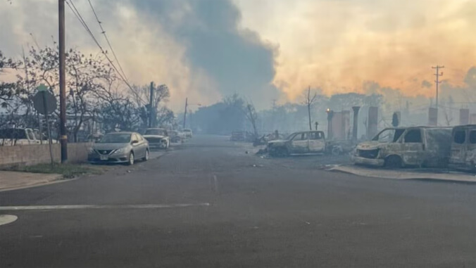
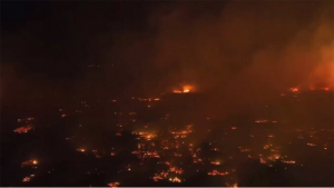
Haunting images of the deadly wildfires in August that displaced thousands on Maui and tragically devastated much of the Valley Isle’s historic town of Lahaina continue to send shockwaves across Hawaiʻi and the globe.

University of Hawaiʻi at Mānoa wildfire expert Clay Trauernicht connects the unprecedented wildfires on Maui and parts of Hawaiʻi Island to an intense combination of factors such as powerful winds, extremely low humidity and underlying drought. However, Trauernicht, who is an extension specialist in ecosystem fire in the UH Mānoa College of Tropical Agriculture and Human Resources Department of Natural Resources and Environmental Management, explains why the flammability of Hawaiʻi’s landscapes has drastically increased.
More on how to help Maui ʻohana and the Maui wildfires.
“Land that was once used for agriculture is now more commonly utilized for residential communities which elevates chances for wildfires. What happens is tropical grasses or shrubs from across the world that thrive in fires take over. Non-native grasses like guinea grass and haole koa significantly increase fire potential,” Trauernicht explained.
Severe winds brought on by a strong area of high pressure north of the state and Hurricane Dora passing far south of the islands, also prevented helicopters from conducting aerial water drops, which could have helped curb the spread of the fires, Trauernicht added.
Wildfire vulnerabilities
Wildland fire is a persistent and increasing threat across Hawaiʻi and inflicts significant burden on federal, state and county emergency management agencies. According to Trauernicht, the annual area burned has increased by 300% across all four counties of Hawaiʻi within the past several decades.
In 2020, Trauernicht joined fellow researchers from UH Mānoa to form a working group that developed a high-resolution fire risk index for Hawaiʻi using spatial data on historical fire occurrence, climate, vegetation and the built environment. According to Trauernicht, Hawaiʻi’s leeward areas are especially vulnerable to wildfires where precipitation isn’t as prevalent.
- Related UH News stories:
UH team to develop wildfire risk system, September 22, 2020
Hurricane Lane brought fire and rain to Hawaiʻi, July 22, 2020
Pacific Islands wildfires highlight vulnerability to climate change and how to address it, August 23, 2021
Study links climate change to increased risk of Hawaiʻi wildfires, December 18, 2018
He said reconfiguring elements of Hawaiʻi’s landscapes can decrease the vulnerability of wildfires.
“We can reduce the risk of wildfires on a larger scale by modifying vegetation and implementing animals for grazing wide areas,” Trauernicht said. “We can also modify irrigation, plant more trees and alter landscapes.”
- Message from UH President David Lassner: Caring for our Maui colleagues, friends and family
- Donations for UH Maui ʻohana: UH Foundation fund for UH Maui College
