
The number of earthquakes in Pāhala, a town located in the southern Kaʻū district of Hawaiʻi Island, have increased 70-fold since 2015, and Earth scientists from the University of Hawaiʻi at Mānoa and the U.S. Geological Survey’s Hawaiian Volcano Observatory (HVO) deployed instruments called seismic nodes to understand why.
Pāhala is currently the most seismically active region in the Hawaiian Islands. Frequent, deep earthquakes (greater than 12 miles below sea level) are felt by residents, however, the current level of activity was not always common to the region, and researchers are trying to understand why.
Since mid-2019, there have been several hundred earthquakes on average each week. And since August 2020, eight magnitude-4.2-to-4.6 earthquakes have been recorded at depths of 19–21 miles.
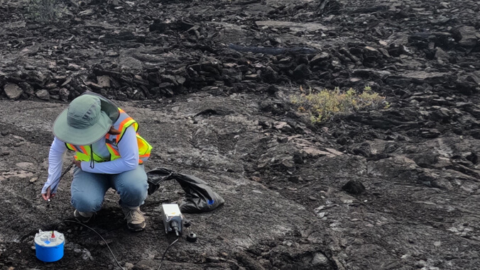
Helen Janiszewski, assistant professor of Earth sciences at UH Mānoa’s School of Ocean and Earth Science and Technology (SOEST), SOEST Earth sciences graduate student Jade Wight, and researchers from HVO, deployed 86 seismic nodes in June to record ground shaking generated by shallow and deep earthquakes across Hawaiʻi Island and distant earthquakes from around the world.
“We are grateful to our collaborators at HVO, our field team, and local landowners and community members for a successful field campaign to deploy the seismic nodes,” said Janiszewski. “We are looking forward to their recovery in a few months, in order to better understand the underlying causes of the ongoing Pāhala earthquake swarm.”
Earthquakes may reveal magma pathways

Unlike permanent seismic stations, which are placed farther apart and cover Hawaiʻi Island, the temporary seismic nodes will be tightly grouped in order to more densely record earthquake signals across the region surrounding Pāhala.
The densely-spaced nodal instruments will collect seismic data at unprecedented resolution. Seismologists at HVO and UH Mānoa will analyze data collected from these seismic nodes to create images of the Earth’s structure beneath Pāhala from 25–31 miles below sea level all the way to the surface.
The data and images will be used to precisely locate the earthquakes in this region and aim to identify or constrain the locations and distributions of shallow and deep fault zones and potential magma pathways within the region. The results will help researchers understand what is causing the frequent earthquake activity in the region beneath Pāhala.
Previous geophysical studies have theorized that deep earthquake activity beneath the Pāhala region may be related to hot spot magma transport and/or faulting in the brittle upper mantle beneath the island. Interestingly, the region is almost equidistant from the summits of the three most active volcanoes in Hawaiʻi: Kīlauea, Mauna Loa and Kamaʻehuakanaloa (formerly Lōʻihi Seamount).
Whether Pāhala has a possible connection to the shallower magma storage and transport systems of Kīlauea or Mauna Loa is unclear, but there are no obvious indicators of magma transport from this region to the surface.
