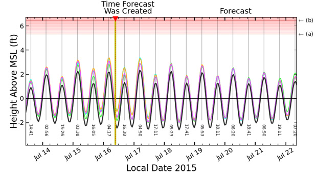
A new Pacific Islands Ocean Observing System (PacIOOS) tool is now available that forecasts the potential occurrence of high sea levels and wave inundation for the most populated segments of Kwajalein Atoll. The forecast is updated hourly and accessible to the public on the PacIOOS website.
“Due to the low elevation of the Marshall Islands, communities are vulnerable to flooding and wave inundation. Storm events, high waves, extreme tides, or a combination of these factors can threaten public health and safety,” said Doug Luther, PacIOOS co-investigator and professor of oceanography at the University of Hawaiʻi at Mānoa. “The forecast will increase community resilience and enhance preparedness by providing decision-makers, agency representatives, and community members with some time to plan in advance of potential flooding events.”
A similar forecast is available for Majuro Atoll and has been tested over the past 10 months. Based on stakeholder feedback, the presentation was recently revised to improve usability and readability. Additionally, inundation heights of several documented events have been added as examples to better communicate the potential threat of approaching events.
The team of researchers will continue to refine the forecasts for both Kwajalein and Majuro, with the support of local partners. “Ground truthing our model outputs is important for increasing accuracy. These forecasts are complex, taking many different oceanic, atmospheric and shoreline parameters into consideration,” explains Martin Guiles, PacIOOS senior physical oceanographic research specialist.
Guiles adds, “The forecasts do not include predictions of tsunamis or storm surge flooding. In case of those events, the public is advised to seek advice from the National Weather Service.”
For more on Kwajalein wave inundation forecasts, visit the PacIOOS website.

