Pacific Marine National Monuments Weather Stations
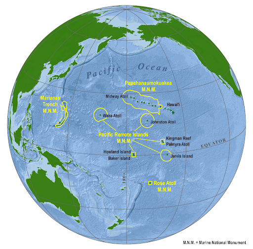
Four Marine National Monuments are within the Pacific Islands region: Papahānaumokuākea, Pacific Remote Islands, Rose Atoll, and Marianas Trench. The Monuments were created to protect the respective areas’ abundant and diverse coral, fish, and seabird populations; important historical and cultural sites; facilitate exploration and scientific research; and promote public education regarding the value of these national treasures. All of the Monuments, except for the Marianas Trench, have important terrestrial and shallow water ecosystems that are National Wildlife Refuges, such as many of the Northwestern Hawaiian Islands, Wake Atoll, Palmyra Atoll, Kingman Reef, Jarvis Island, Howland Island, Baker Island, and Rose Atoll.
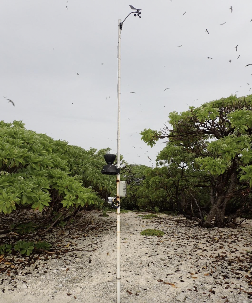
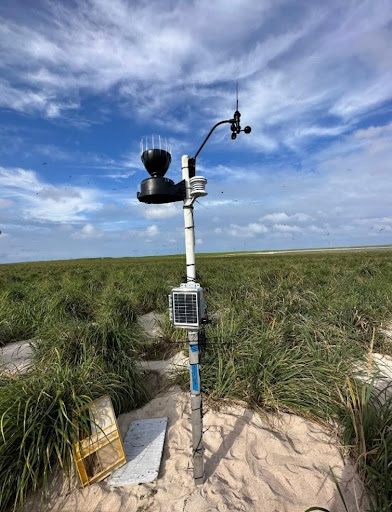
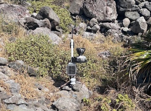
Environmental conditions (e.g., temperature and precipitation) are some of the major drivers of species distribution and abundance in terrestrial habitats within the Monuments, and they are relatively inexpensive to measure. The US Fish and Wildlife Service’s Pacific Islands Refuges and Monuments Office has weather stations in multiple locations within the Monuments and plans to deploy more in the future. Having continuous environmental data adds value to field work by allowing to interpret the results of infrequent (due to the remoteness of the locations) field surveys better and aids understanding of how monument ecosystems and populations of interest respond to management actions or anthropogenic impacts (e.g., invasive species and climate change). Environmental data give biologists and managers an increased ability to sift through the myriad competing hypotheses surrounding observed changes or results of a management action. Such data is also helpful in doing predictive modeling, something essential given the uncertainty in future climate predictions.
Here are some ways environmental data is used at various Monument locations, where it is monitored in real-time.
Hyperthermia and Nest Flooding
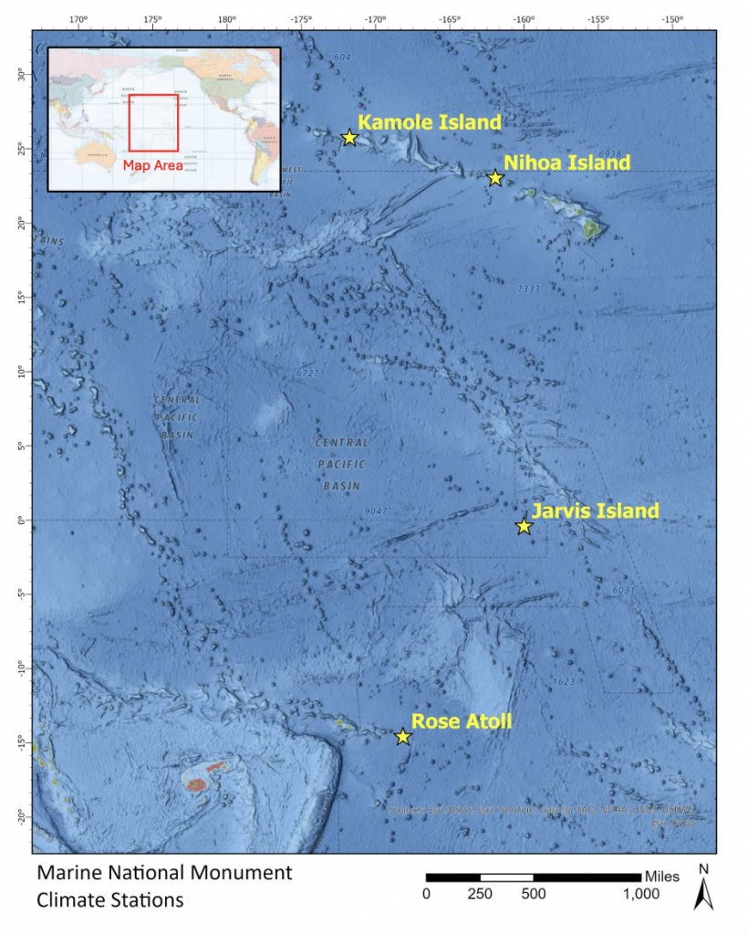
Kamole (Laysan) Island in Papahānaumokuākea MNM is one of the few places in the world where Blackfooted (Kaʻupu) and Laysan Albatross (Mōlī) nest, with most of the other locations occurring on neighboring islands within the northwestern Hawaiian Islands. On Kamole, temperatures can sometimes exceed the thermal tolerance of these albatross. The birds have ways of cooling off when they get too hot, often relying on the cool tradewinds. However, when hot days coincide with days of little to no tradewinds, birds can overheat and die of hyperthermia. Relatedly, the survival of eggs and chicks along the shoreline of Kamole’s hypersaline lake (in the island’s interior) is dependent upon weather, though, in this case, rainfall. Lake levels are controlled by rainfall, and if increasing lake levels are mistimed with albatross nesting, it can result in egg and chick mortality along the shores of the lake. Information on air temperature, wind speed, and rainfall is helping managers better understand the potential severity of hyperthermia and flooding-induced mortality of albatross populations on Kamole at annual and longer time frames.
Invasive Plant Management
Nihoa Island in Papahānaumokuākea MNM is one of only two high islands in Monuments. Free from many of the anthropogenic impacts experienced by the other high islands in the chain, Nihoa is home to a unique and diverse community of plants and animals found nowhere else in the Hawaiian archipelago. Nihoa was also the staging location of Native Hawaiians for trips to Mokumanamana, where important political and religious ceremonies were held. As such, there are many cultural sites on Nihoa. Invasive species, such as ants and grasses, are significant threats to native ecosystems on Nihoa. For example, the invasive long-spined sandbur (Cenchrus echinatus) is spreading on Nihoa. It threatens to displace native grasses and permanently alter the plant and animal community on the island. Managers use continuous environmental data, such as rainfall and soil moisture, to help plan trips when C. echinatus is visible above ground, which is directly related to rainfall and is necessary for treating C. echinatus.
Phenology
Jarvis Island National Wildlife Refuge, in the Pacific Remote Islands MNM, was established in 1974 and is located 1,305 nautical miles south of Honolulu. Its lands and waters serve as an invaluable habitat for many species of tropical seabirds, as well as abundant populations of terrestrial land crabs and many coral reef species, such as giant clams. The island also has many historic sites from the guano mining era and military activities during the World Wars. Trips to Jarvis are infrequent due to its remoteness, and very little is known about its ecology. Biologists at the USFWS are combining remotely monitored environmental data collected from satellite weather stations with satellite imagery to help better understand the phenology (timings of cyclical or seasonal biological events), such as nesting of seabirds and the onset of vegetation greening, etc., and the environmental drivers of that seasonality.
Sand Temperature and Storms
Rose Island (i.e., Motu O Manu, Nu’u o Manu, or Muliava), in the Rose Atoll MNM, is an important nesting site for endangered green sea turtles and tropical seabirds in American Samoa. Increased air temperature due to human-induced climate change has caused concern regarding the future of the sex ratio of sea turtle hatchlings, which are temperature dependent. In addition, storms, such as hurricanes, are one of the natural drivers of the island’s plant community. The USFWS deployed a satellite weather station to help biologists and the Monument manager better understand how environmental conditions on Rose influence biological resources—for example, baseline data on sand temperature and how it is affected by other factors like precipitation. Wind speed measurements during storms of various sizes will help managers understand how wind speed relates to the disturbance of plant communities on Rose Island.