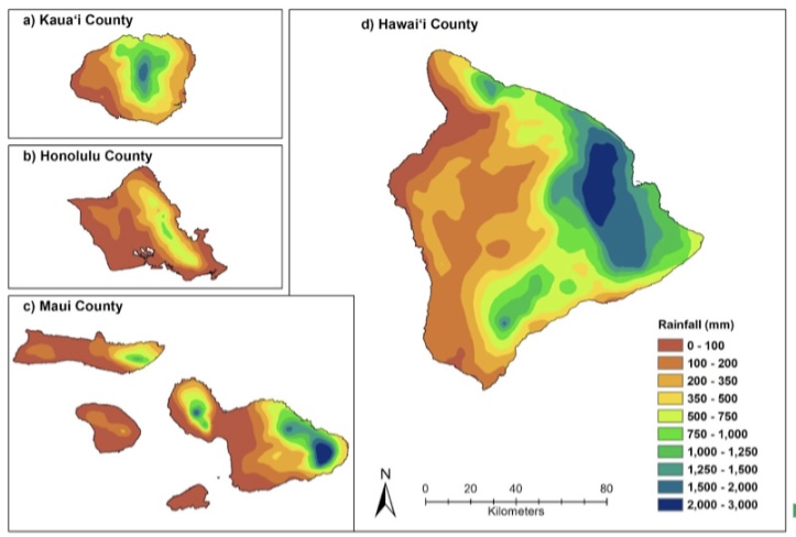
Mapping rainfall over the complex topography of Hawai‘i is not easy. It’s difficult to produce a good quality map that captures the extreme gradients and spatial variability of rainfall in the islands. To overcome this obstacle, a new method has been developed by Matt Lucas from the Water Resources Research Center at UH to create maps using an optimized geostatistical kriging approach. A key finding is that optimization of the interpolation approach is necessary because maps may validate well (low errors) but have unrealistic spatial patterns.
A paper describing these methods was recently published in the Journal of Hydrometeorology (Optimizing Automated Kriging to Improve Spatial Interpolation of Monthly Rainfall over Complex Terrain).
These methods are currently being used to produce the monthly rainfall maps that are available for visualization and download in the Hawai‘i Climate Data Portal.