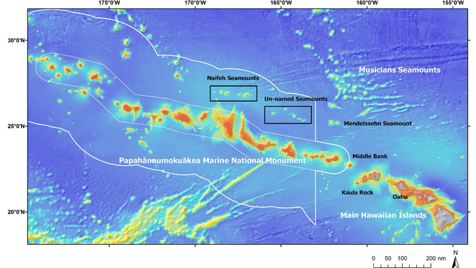

From September 15 through October 1, 2018, scientists aboard the Exploration Vessel (E/V) Nautilus will be exploring seamounts at Papahānaumokuākea Marine National Monument. This deep-sea exploration will be live streaming at NautilusLive.org with an interactive question and answer section for audiences worldwide.
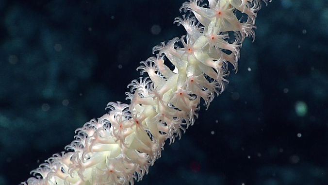
“We think that there could be incredible coral and sponge gardens on these seamounts based on previous work that was done nearby both inside and outside the monument,” said Christopher Kelley, an oceanographer at the University of Hawaiʻi at Mānoa School of Ocean and Earth Science and Technology.
Researchers will conduct seafloor mapping and remotely operated vehicle (ROV) dives on unexplored seamounts to help determine how and when they formed and to document the biological communities that presently live on them. ROVs will survey seamounts located between the Musicians Seamounts and the Hawaiian ridge for the presence of deep, high-density coral and sponge communities. Activities will be live-streamed around the clock, viewable from any computer with an internet connection.
Kelley is co-lead scientist on the expedition with Thomas Hourigan of the National Oceanic and Atmospheric Administration Deep-Sea Coral Research and Technology Program. The expedition leader is Allison Fundis with Ocean Exploration Trust.
The project is part of the broader 2018 Nautilus Expedition exploring the Eastern Pacific Ocean, surveying unexplored regions from British Columbia, Canada, along the West Coast of the United States, and west to the Hawaiian Islands. The platform is E/V Nautilus, a 64-meter (211-foot) research vessel crewed by 48 scientists, engineers, professional mariners, educators and students, and operated by the Ocean Exploration Trust.
For the full story, see the School of Ocean and Earth Science and Technology website.
—By Marcie Grabowski